Record-Low High Temperatures Set in Brevard Tuesday; Mostly Sunny, High of 72 Forecast for Wednesday
By Space Coast Daily // November 12, 2025
Break Out the Jackets!
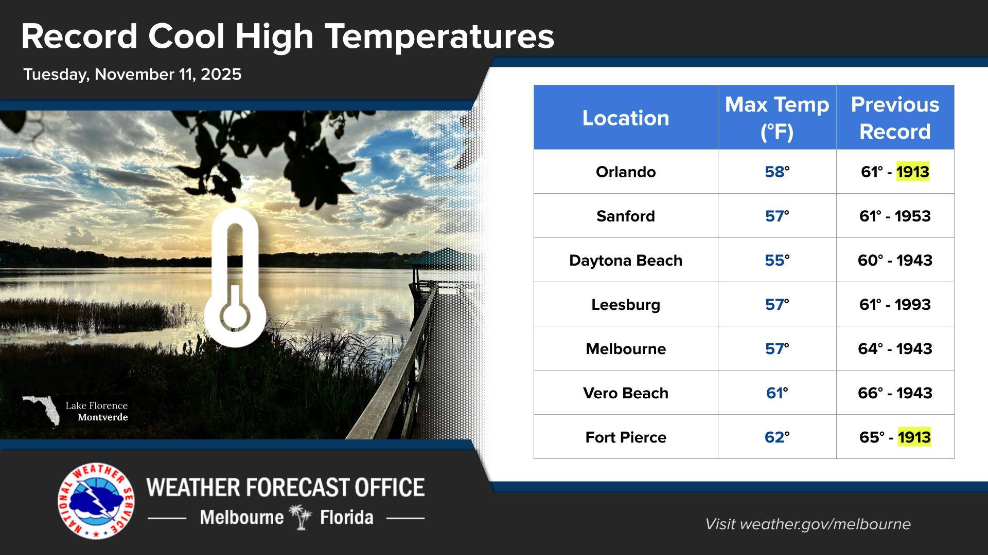
Tuesday was a blustery, chilly day with max temps about 20 degrees below normal. This produced record-low high temperatures across east central Florida, after record lows this morning. Temperatures will fall quickly Tuesday night with patchy to areas of frost developing north of Orlando late Tuesday night into early Wednesday.
Wednesday: Mostly sunny and pleasant, with a high around 73 °F (23 °C) and a low about 46 °F (8 °C). Tip: Perfect day for errands or a stroll—morning is chillier, but midday opens up nicely.
Thursday: Another pleasant day. Sunshine dominates, high near 75 °F (24 °C), low around 53 °F (12 °C). Tip: Light layers will be enough; you’ll likely find yourself comfortable in just a long-sleeve or light jacket.
Friday: Very similar to Thursday: plenty of sunshine, high around 76 °F (25 °C) and low near 61 °F (16 °C). Tip: A great day to get outside—maybe plan something outdoors if you’ve been waiting for nicer weather.
Saturday: Looks like another fine day: high near 78 °F (26 °C) and low around 60 °F (16 °C). Sunshine, warm air, and no major weather hazards. Tip: Ideal for outdoor hobbies, relaxed time by the water, or catching up on whatever you’ve got.
 Related Story:
HOT OFF THE PRESS! October 27, 2025 Space Coast Daily News – Brevard County’s Best Newspaper